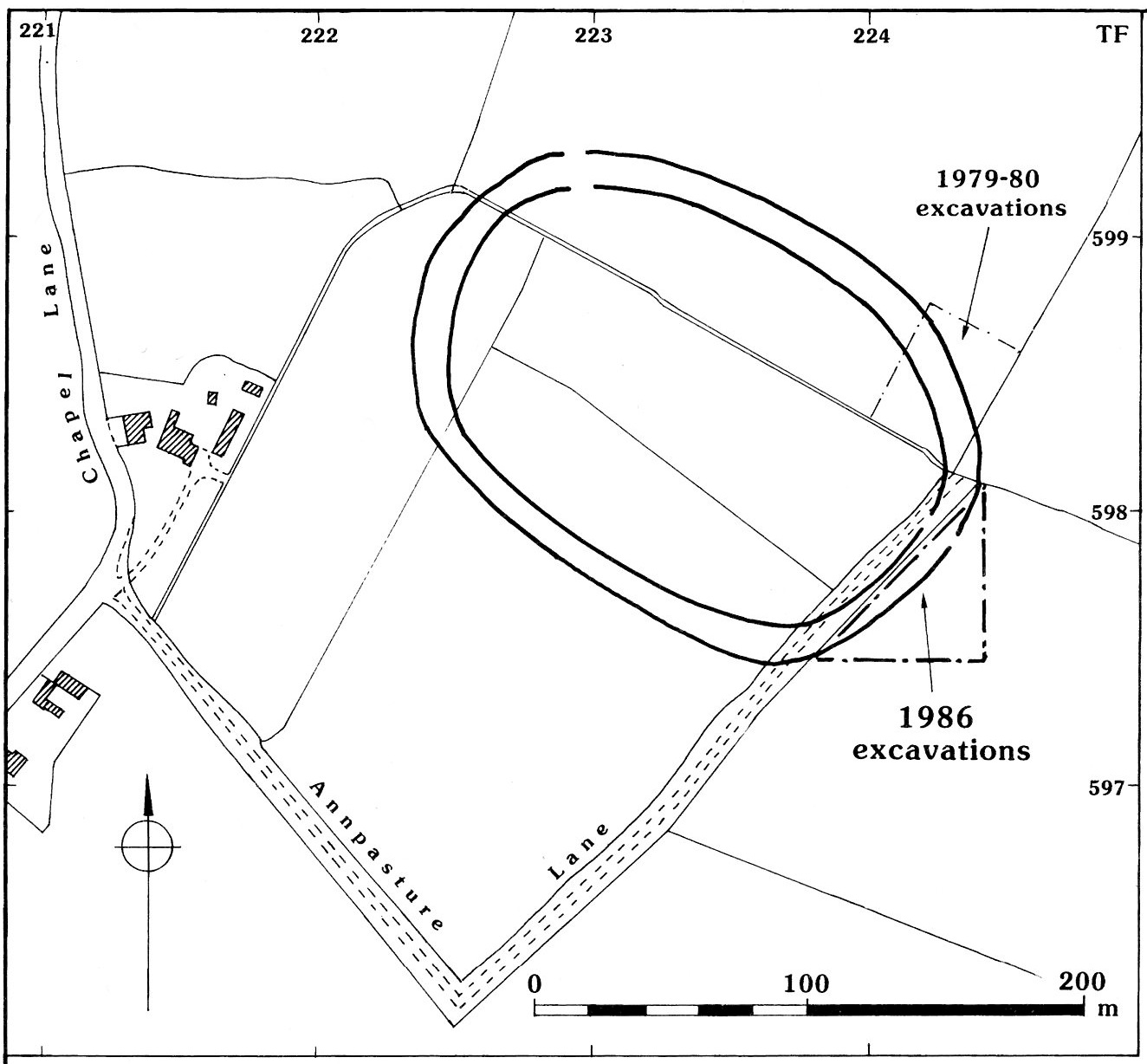
 The Iron Age enclosure at Tattershall Thorpe first came to the attention of the North Lincolnshire Archaeological Unit in 1976 when Paul Everson recorded the crop mark of a large oval double-ditched enclosure during aerial reconnaissance. The site had been photographed by Professor J. K. St Joseph in 1975, but the prints, which show the site before quarrying began, did not become available until after the excavation had been completed.
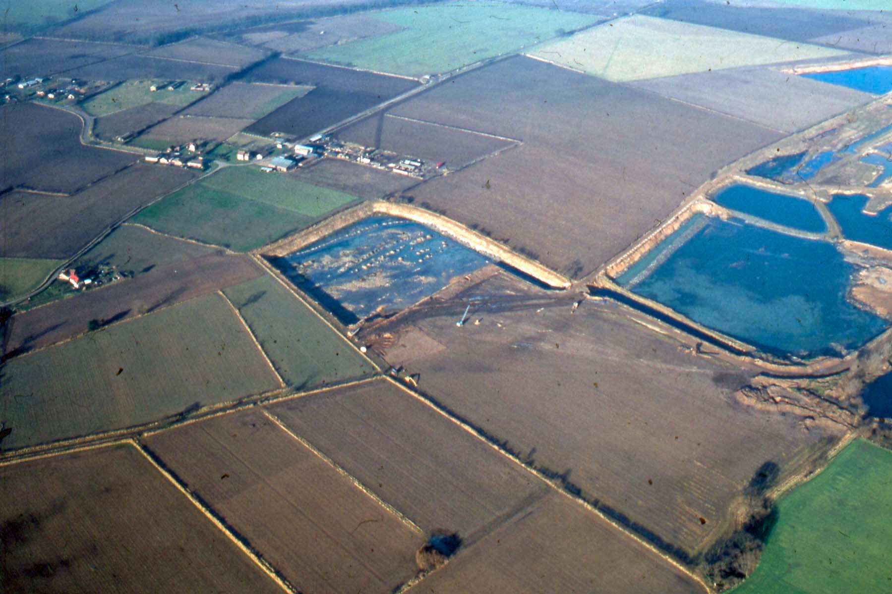
Photo: P. Everson
The enclosure is situated on sands and gravels at an elevation of 9.2 m OD overlooking the Bain and Witham Valleys. The gravels are acidic and free draining except where an iron-pan has formed causing localized water-logging. Although much of the land in this area is now arable it can, at best, be described as generally of poor quality. A considerable amount of pasture still exists, particularly close to the river which floods frequently. To the north of the enclosure on the Kirkby Moor sands large areas of land are under recent pine forest or heathland.
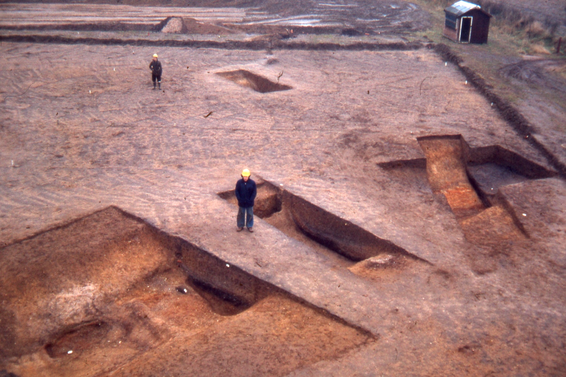
Inner ditch in foreground with one section through the outer ditch visible in the distance. The archaeologists are standing at the centre of the ditches
The average surviving depth of the outer ditch was 1.45 m with the ploughsoil removed; ancient and modern ploughing have truncated the ditches by an unknown amount. The average width was 5 m and the ditch bottom was rounded. It should be borne in mind that the ditch as excavated was in its final form as abandoned and may have been cleaned out on numerous occasions during its period of use. No physical evidence for a bank adjacent to either ditch was discovered although they probably existed. However, considerable environmental evidence for the presence of hedges was found within the organic ditch layers. Two objects were recovered from the outer ditch, a sherd of pottery and a piece of carbonised wood which showed no signs of having been worked. A radiocarbon date of 770-200 cal BC has been obtained from the wood and is consistent with pottery dating the early use of the site to the 5th-3rd centuries BC. Both of these objects were found on top of organic lower ditch filling, from a time when the enclosure was going out of use or its role had changed and the ditches were not being maintained.
Outer ditch section
The average depth of the inner ditch was 90 cm with the plough soil removed and the average width was 5.75 m. Unlike the outer ditch which was U-shaped, the inner ditch was flat-bottomed. The sequence of deposits varied little from those of the outer ditch except in one section which had been recut. Uniformity of the ditch bottom was interrupted in one area. The ditch at this point had never been dug to the depth encountered in the other sections, thus leaving a slight causeway. North of the causeway an oval pit had been cut into the ditch bottom. Set into the causeway were two posts; the outline of one post was visible and averaged 50 cm in diameter. The second post was in an oval hole. Farther south another post-hole was located. A small amount of pottery was found lying on top of the organic ditch layer but the majority of artefacts were recovered from the recut. These include pottery dating to the early part of the 1st century AD, fired clay, animal bone and charcoal.
There can be little doubt that the size of the ditches at Tattershall Thorpe indicates that their primary role was defence. Although there was no structural evidence for the presence of ramparts, the distance between the ditches provided ample room for substantial banks. Evidence for the presence of hedges has been mentioned above and it is possible that they formed part of the defensive system or were used as a means of stock control to prevent erosion of the ditch sides by grazing beasts. It is also conceivable that some of the post-holes and pits held wooden uprights which formed part of the defences. Equally they may have been part of a structure associated with a crossing of the ditch. The existence of a slight causeway at this point may be further evidence for a crossing point. A third, and less convincing, interpretation might be that these features simply held markers for construction teams who met at this point. The site has been referred to as an Iron Age Defended Enclosure on the basis of its substantial ditches. However, it is by no means certain that the enclosure even had a military role and served as a fort. Whilst this function cannot be dismissed it must remain no more than a possibility until more evidence becomes available.
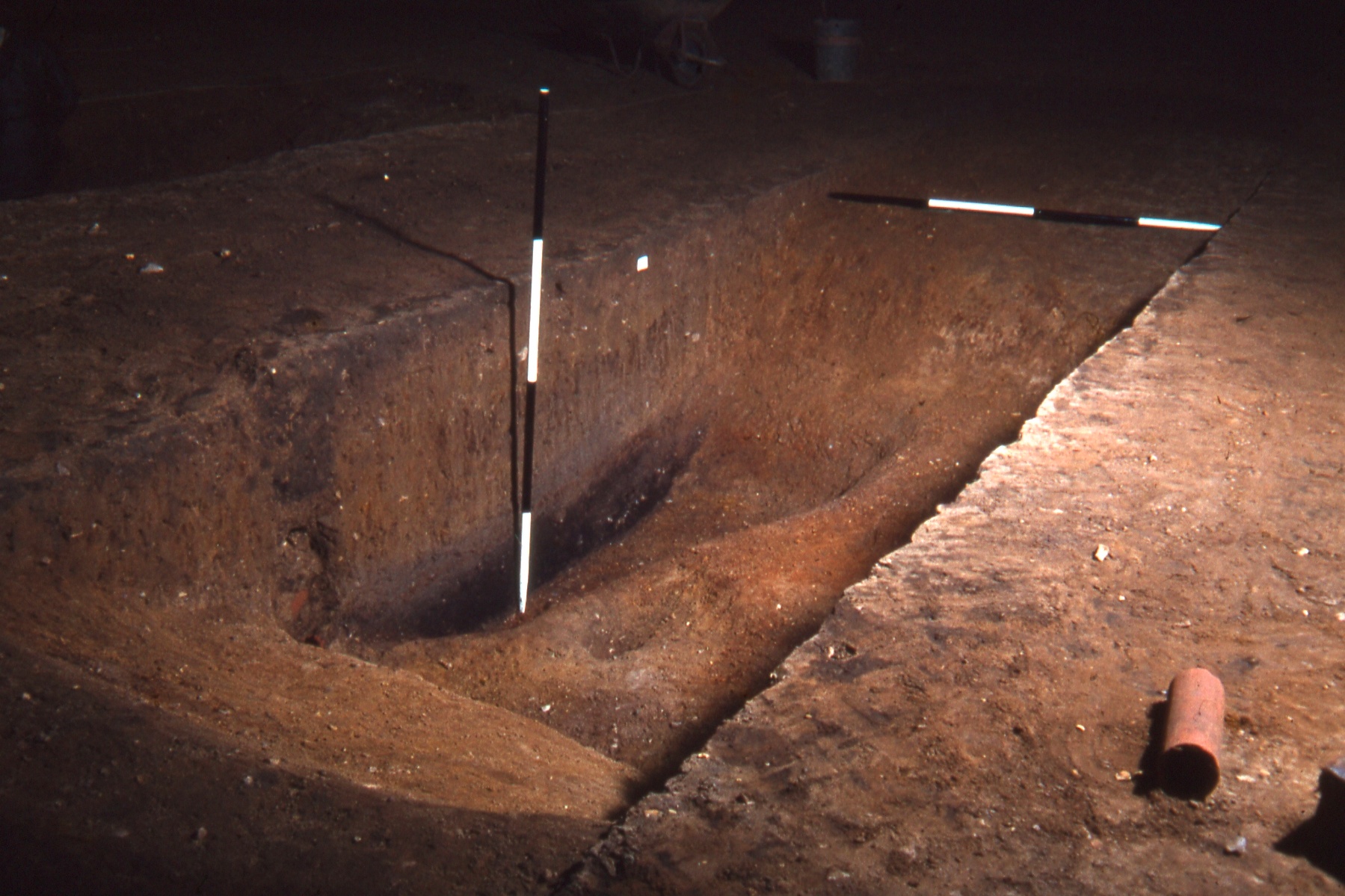
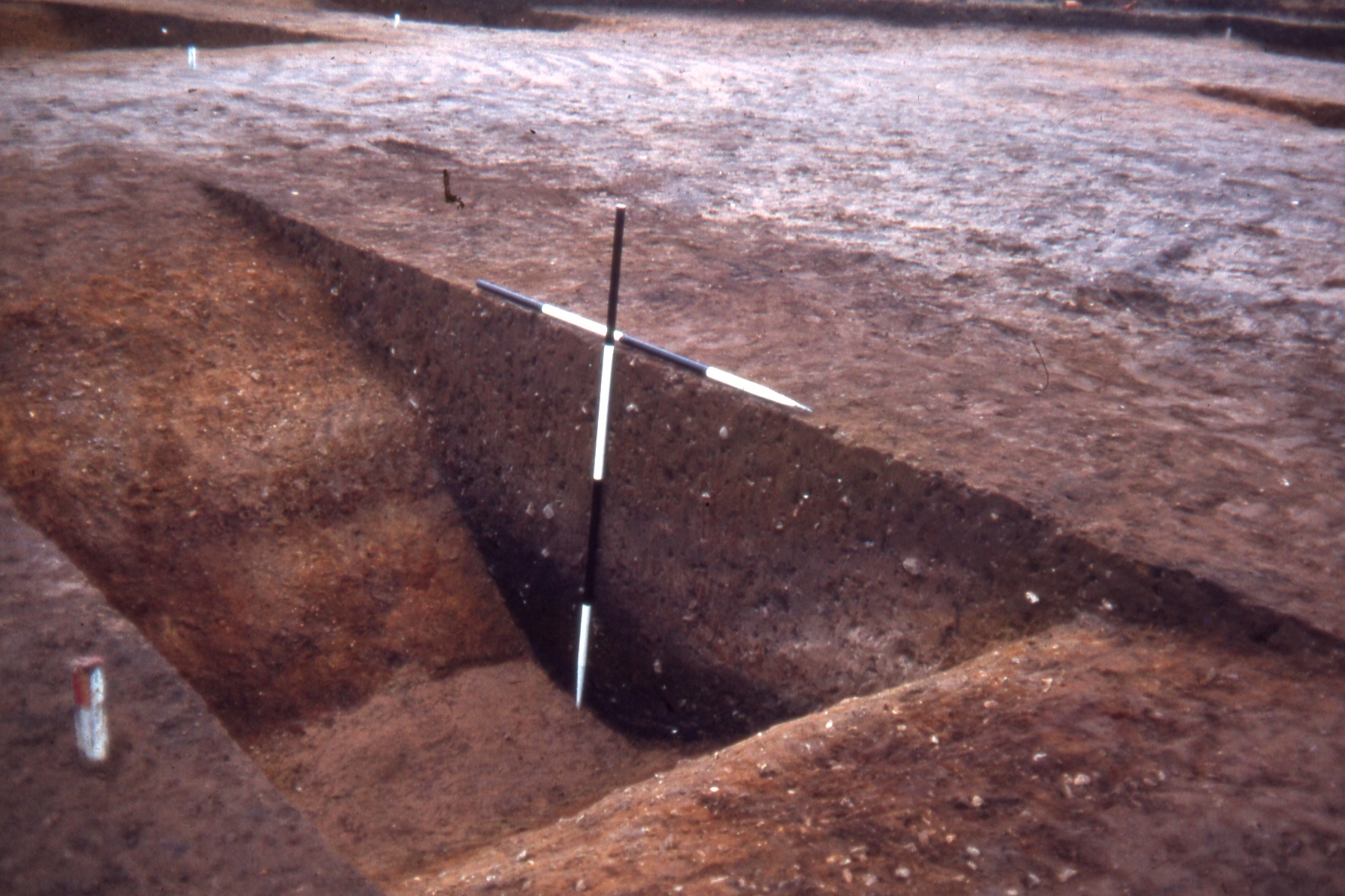
Inner ditch section
The extensive evidence for stock grazing suggests an alternative use for the site. To the east, south and west of the enclosure are large tracts of fen and marsh. During the summer months these wet land areas probably provided excellent summer grazing but in the winter stock would have been rounded up and taken to a centre where animals were reclaimed by their owners, some possibly being slaughtered for hides and meat, some being exchanged, others perhaps taken up the Bain Valley to graze on the riverside meadows and even on to the Wolds. During the spring a similar event may have taken place when stock was branded before being run freely on the summer pastures. Given the value of stock to many societies, there may have been a need for defensive ditches at Tattershall Thorpe to deter rustlers and predatory animals. The absence of animal bones within the enclosure ditches, a result of acid soil conditions, is unfortunate in that the type of stock grazing at Tattershall Thorpe cannot be established.
In 1986 planning permission was granted for gravel extraction in an adjacent field containing approximately a hundred metres of the outer ditch at the south-eastern end of the enclosure. The inner ditch at this point lies beneath a modern footpath and was not therefore available for investigation.
 The topsoil and upper fillings of the ditch were removed by machine with a toothless grading bucket. Where other archaeological features were encountered, the trench was widened beyond the line of the ditch. A series of segments, each initially approximately 2 m wide, was then excavated manually through the lower ditch fillings, although many segments were subsequently widened resulting in the complete emptying of longer sections of the ditch. It was decided not to duplicate the plant macrofossil, pollen and insect data collected during the 1979 excavations and instead samples were taken for soil micromorphological and particle size analysis and a full programme of wood analysis examining woodland management practices and woodworking techniques was undertaken to complement this earlier work.
Unlike the entrance causeway across the inner ditch, where the line of the ditch was continuous but not dug to the same depth encountered along the rest of its length, the entrance in the outer ditch was flanked by the terminals of two separate ditches. The dimensions of the ditch was comparable to those recorded during the 1979 excavations. The profile was a wide U-shape, the slight irregularities in their sides probably resulting from variability in the gravel subsoil. As in 1979 large quantities of wood, likely to be cuttings or damaged roots perhaps from hedges, were found in the base of the ditch.
Seager Smith, R.H., 1998. Further Excavations at the Iron Age Enclosure at Tattershall Thorpe, Lincolnshire, by Peter Chowne,1986. Lincolnshire History & Archaeology, 33, 7-19.