Dyke Survey, the recording of recently recut drains in the Fenland, was used as a method of understanding depositional sequences in the western fens. The potential was identified by Brian Simmons of the Car Dyke Research Group during the 1970s in Dyke Fen where the Black Sluice Internal Drainage Board had exposed two layers of peat separated by clay.
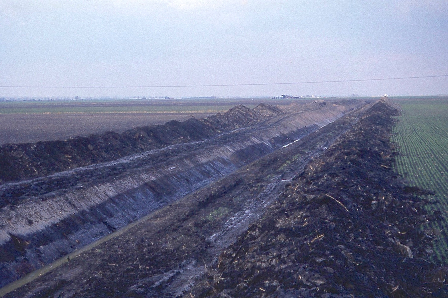
Dyke Section, note the thick lower peat layer and a marine silt roddon in the distance
This was interpreted as a Mesolithic lower peat, Neolithic clay deposition overlain by Late Bronze Age peat the uppermost and surface layer based on research carried out in the Cambridgeshire fens. We now know that the depositional sequences are more complex and often localised.
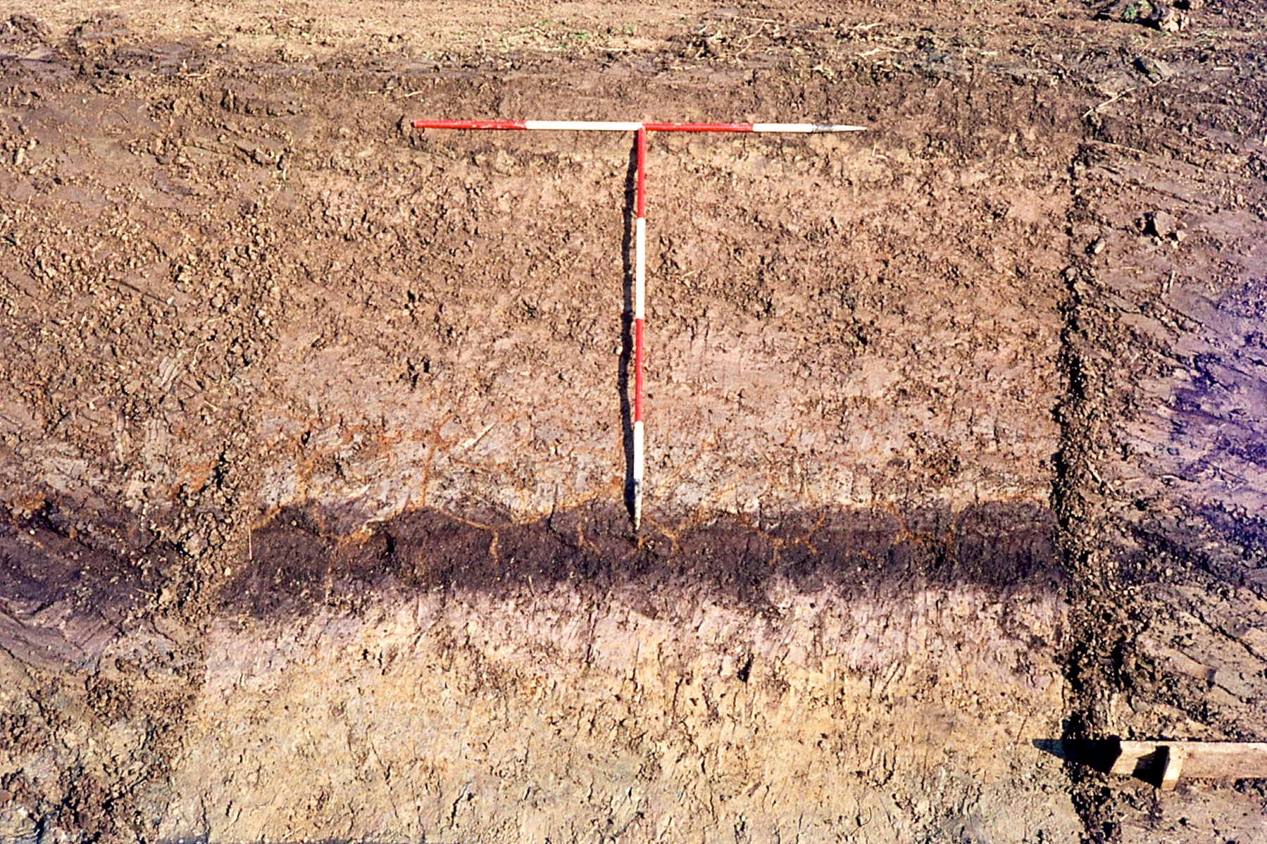
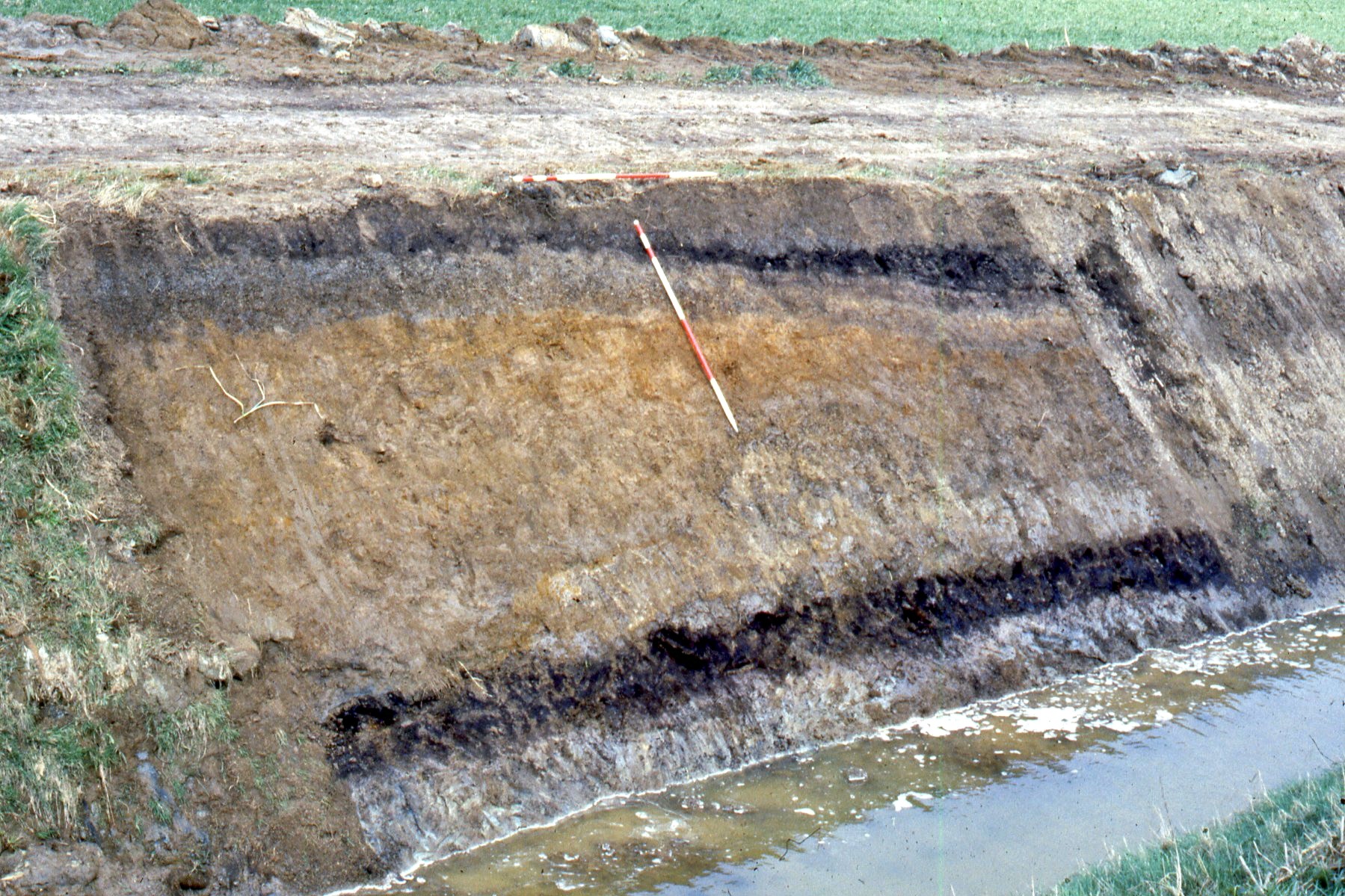
At Horbling Fen a 2 km length of drain was recorded and samples extracted by mechanical auger for palaeoenvironmental analysis. This section extended from close to the South Fourty Foot Drain almost to the Western Fen Edge. At the eastern end of the section the sequence shows a thick layer of till, the top of which is weathered and contained pockets of charcoal for which a radiocarbon date of 2455-1790 cal BC has been obtained. Overlying this layer is a thin band of peat dated to 1440-1010 cal BC.
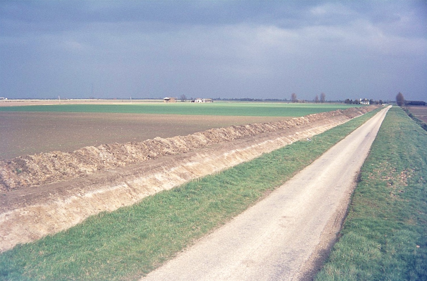
Horbling Fen, western section, with the South Forty Foot drain on the horizon
The peat layer suggests a fen environment where the vegetation has been decomposed by the action of water and may indicate a climatic deterioration. Above the peat there is a lagoonal deposit underlying a thick layer of silt. The silt was laid down in a saltmarsh environment. At the western end of the section the sequence is slightly different.
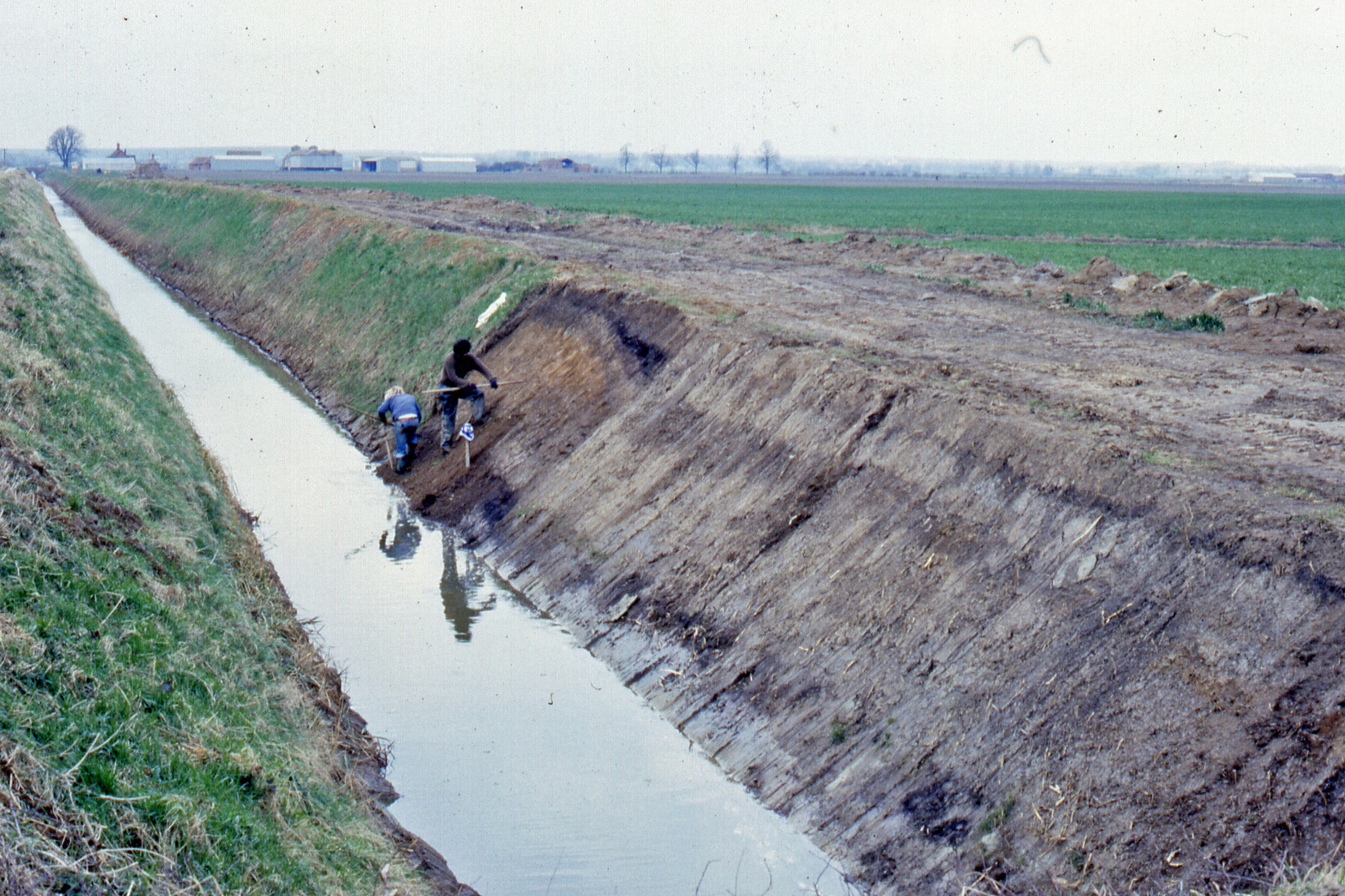
Horbling Fen, eastern section
The till underlies coarse calcareous fluvoglacial gravels which, themselves, underlie blown sand (Southrey Terrace). Above this layer are tidal marsh deposits. The lower tidal marsh deposit is cut by several ditches which may relate to the extensive field system discovered at Billingborough on the fen margin (Chowne 1980).
Hacconby Fen, eastern section
Farther south at Hacconby Fen in a 3 km section the sequence was till the top of which was a buried land surface containing charcoal. A layer of peat had formed over this and was in turn covered by freshwater clay and marine silt (Chowne 1998).
The latter deposit was thicker here than in Horbling perhaps reflecting the southward inclination of the fen basin from Dowsby towards Bourne. The peat was radiocarbon dated to 2030-1660 cal BC suggesting that this was wetland during the early part of the Bronze Age slightly earlier than at Horbling.
Hacconby Fen, eastern section
Dyke survey methodology was also used by the Fenland Project in Cambridgeshire (French & Pryor 1993) and at Wildmore Fen and West Fen where sections of Castle Dyke and Howbridge Drain were recorded (Waller 1994). Radiocarbon dates, lithostratigraphic and pollen analysis suggest the landward advance of marine and fen environments from the Late Neolithic in the North-western fens.
Re-profiling of dykes in the areas managed by the internal drainage boards is less extensive than in the past but is still carried out, sometimes in response to slumping, as part of regular maintenance. Observing and where appropriate recording sections is a useful method of enhancing our understanding of fenland and river valley depositional sequences and can make a positive contribution to the environmental programmes of the Internal Drainage Boards.
Chowne, P., 1980a. Bronze Age Settlement in south Lincolnshire, in Settlement and Society in the British Later Bronze Age, eds. J.C. Barrett & R.J. Bradley. Oxford: BAR Brit Ser 83, 295-305.
Chowne, P., 1988. Aspects of Later Prehistoric Settlement in Lincolnshire: a Study of the Western Fen Margin and Bain Valley, Nottingham: University of Nottingham.